Analysis of Contributing Factors of NYC Flash Floods
Impact Analyzing of Contribution Factors of NYC Flash flooding
Worked On By: Yihan X, Alan Y, Guang T, Yordon N, Ziqian D
Flood vulnerability varies sharply across New York City’s neighborhoods. Beyond heavy rain and storm tides, local infrastructure, landforms, and socioeconomic conditions can tip the balance between safety and disaster. Our project maps these drivers at the community level: climate, topography, infrastructure, and demographics, to reveal where risks are highest and why, providing a more comprehensive analysis of the factors that influence flood risk.
Our Mission
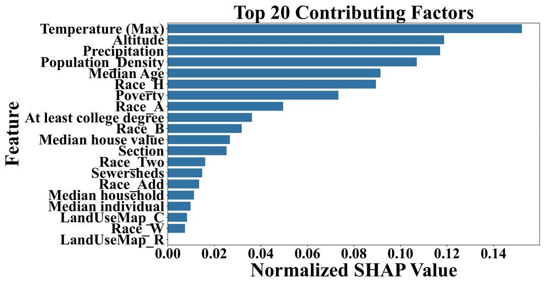
Our mission is to build a comprehensive and interpretable model of flood risk in New York City by assembling a multi-modal dataset that combines climate patterns, land elevation, infrastructure conditions, and socioeconomic data. This initiative focuses on identifying which communities are most exposed to flooding by connecting environmental hazards with factors such as income, home values, race, and educational attainment. Our findings show that maximum temperature and precipitation are key contributors to flood risk, while low elevation significantly increases exposure. Neighborhoods that are densely populated, lower-income, and home to minority populations tend to face the greatest vulnerability. In contrast, areas with higher levels of education are often better equipped to take proactive measures that mitigate risk. Flood vulnerability across New York City is not uniform. It is shaped not only by natural events like rainfall and storm surges but also by the built environment and social dynamics that influence a community’s ability to prepare for and respond to flooding. By mapping these relationships at the neighborhood level, our project provides a clearer understanding of where flood risks are highest and why.
Research Objectives
The research objectives of this project are to:
- Assemble a multi-modal flood-risk dataset for New York City
- Build an interpretable machine-learning
- Linking the areas vulnerable to flooding with income, home values, race, education indicators, and so on
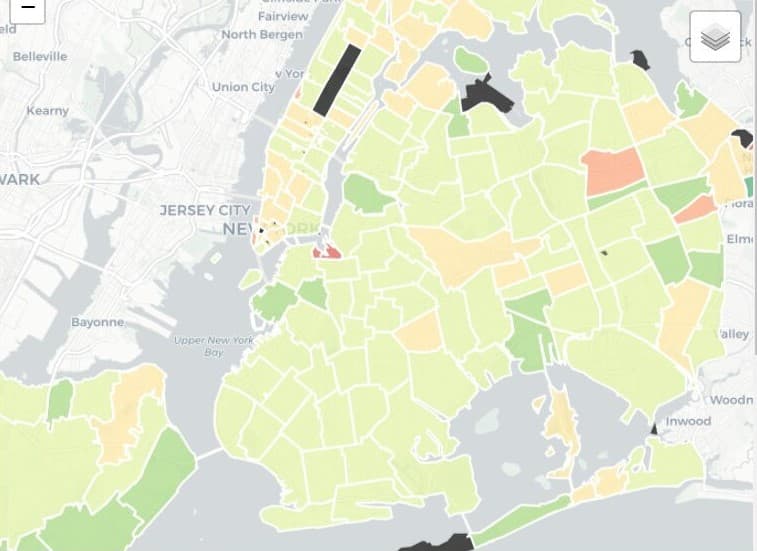
- Use our visual tool for further visual analysis on flooding data